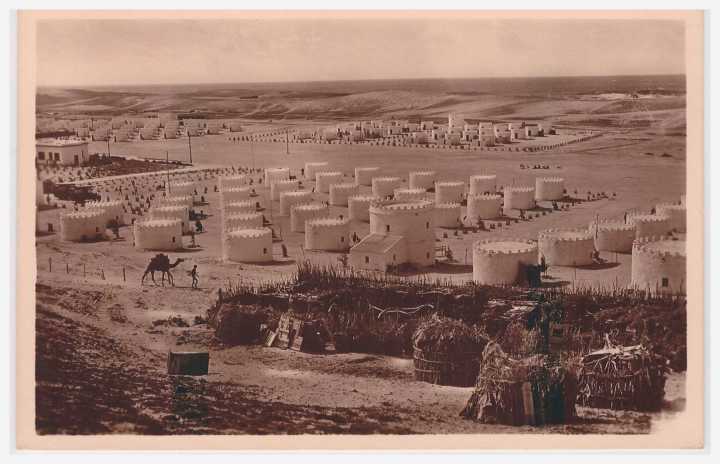
I visited Qandala in late 1991, travelling overnight by boat along the coast from Bossaso. A memorable trip!
G. Revoil described his travels along this coast 100 years beforehand in Voyage au pays des Medjourtaines (Cap Gardufui – Afrique Orientale), pages 254-269, Bulletin de la Societe de Geographie, Mars 1880.
![gandala1]() Here is a drawing of the town as seen from the sea. One of the two taller (mud-brick?) buildings could still be seen in 1991
Here is a drawing of the town as seen from the sea. One of the two taller (mud-brick?) buildings could still be seen in 1991
The map below shows Qandala in relation to Bender Khor, also labeled Boutiala. Boutiala/Botiala is a site of some antiquity, as described in this Wikipedia entry
![boutiala]() With the help of Google Translate, I have translated Revoil’s description of Bender Khor [its a very rough translation]
With the help of Google Translate, I have translated Revoil’s description of Bender Khor [its a very rough translation]
Two different times I visit Khor Bender or Bottiala . This city is about six miles from the coast , on an island formed by the two arms of dried up Khori , a stream which pours into the sea through narrow and steep gorges. The sea arrives into these gorges, washes to the first huts of the city, maintaining a depth around 5 to 6 cubits or doudouns, which allows small sambucos or dhows to come loaded with mechandises to Bender Khor .
Bender Khor is unquestionably the city where the traveller may be the best at what he has before his eyes , refer to the first era of civilization of the people. Four adobe forts guard the gorge, complete with all defence accessories. The cemetery is placed right in the middle of the village and from the mosque, the huts scattered symmetrically under the protection of the forts: …… , contributed to this locality trapped in a huge amphitheatre and a great character that strikes the attention.
Here is his drawing of the town of Bender Khor
![Bender Khor]() There is very little left of this town at present, as can be seen in the Google Maps photo below (Lat 11° 28.538′, Lon 49° 56.947′)
There is very little left of this town at present, as can be seen in the Google Maps photo below (Lat 11° 28.538′, Lon 49° 56.947′)
![Screenshot 2014-01-12 16.39.31 Bender Khor]()
The location of the four forts mentioned by Revoil is not clear. On the Revoil map shown above one high point is marked with a C, and this corresponds roughly with the ruins shown in the Google Maps photo shown below. They stand on the edge of a small plateau, about 200 metres to the west of Bender Khor, at Lat 11° 28.538′, Lon 49° 56.947′ The structure is perhaps 25 x 30 metres in size. The irregular extension to the top right of the structure may be a more recent addition, perhaps an animal enclosure.
![Qandala]()
This Google elevated view provides another perspective
![Screenshot 2014-01-12 17.56.18]()
Further towards the coast there are remains of other buildings, which may have been Revoil’s four forts.
They are between 10 and 20 metres square in size
![Screenshot 2014-01-12 18.01.01]()
The Wikipedia entry also says “To the north of the fortress complex is an impressive field of approximately 200 stone cairns (taalo) of varying sizes, some of which are associated with standing stones. Close by and along the shoreline are extensive shell middens. Neither structures have yet been excavated or dated“
This Google photo may show the cairns. I thought at first they were wells, but no longer think so. They are to the immediate south-west of the “four forts”
![Screenshot 2014-01-12 18.31.40]()
And here is a view of the same coastal valley, taken from the coast looking inland (found via Panoramio).
The gorge referred to by Revoil looks more impressive from this angle. The remains of the “four forts” may be visible on the right, above the first modest sized dark cliff overlooking the waterway
![48678760]()
Filed under: 1800 < before, Aerial photographs, NE Somalia ![]()
![]()
 Courtesy of Panoramio Google Maps


